Satellite Image Segmentation
Built and trained an autoencoder for satellite image segmentation into color-coded land types, with self-tuned architecture and training.
Highlight Contributions
- Optimized and iterated on model architectures, testing various techniques to improve accuracy.
- Programmed and trained the model for effective performance.
Introduction
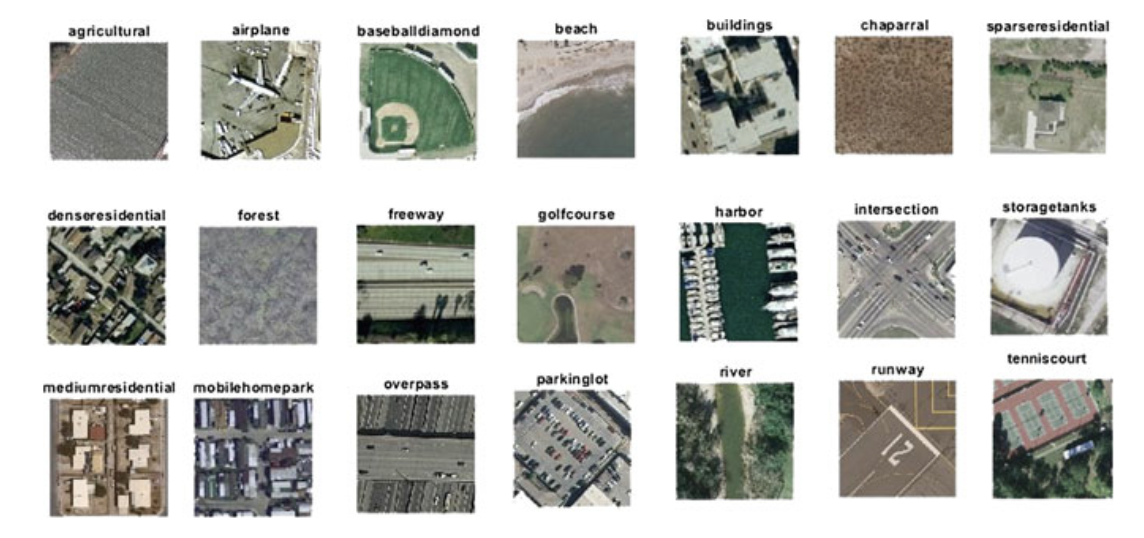
The Satellite Image Segmentation project developed and trained an autoencoder to automatically categorize and segment land covers from satellite imagery, producing color-coded outputs for applications ranging from land cover monitoring to natural disaster detection.
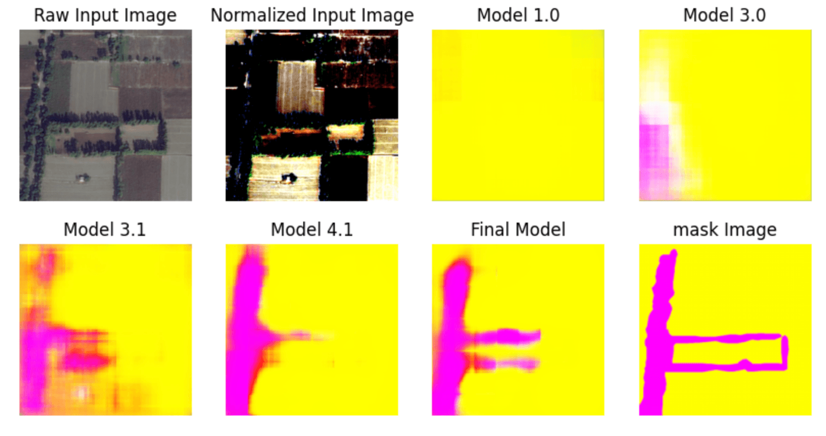
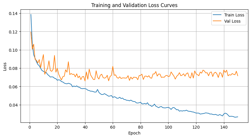
Interation of Model Structure
By iterating on the model structure (Figure 1), we achieved clear improvements in segmentation accuracy with a fully self-built model trained from scratch, without pretraining.
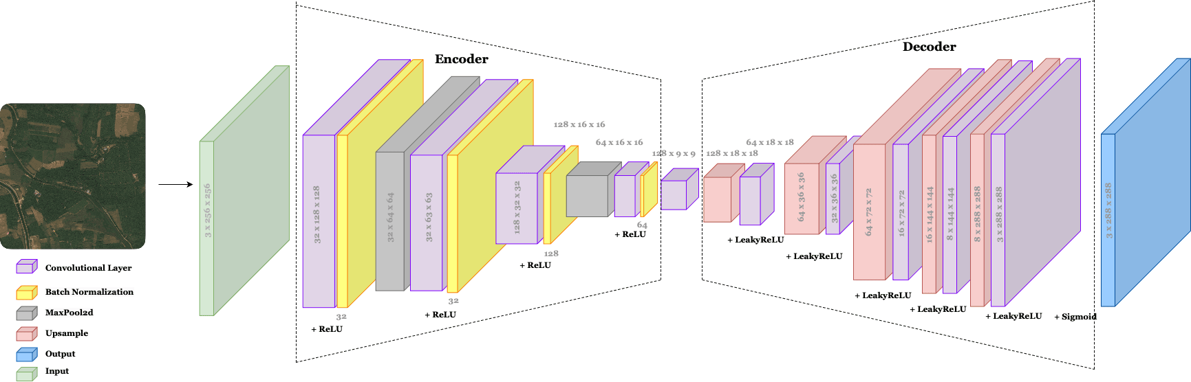
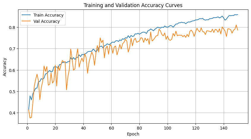
We've setteled down in the final model architecture as illustrated in Figure 2, and their training accuracy and loss function can be found in the Figure 3 & 4.
Acknowledgements
This project was a team effort. Credit to my wonderful teammates - Yijie, Emma, and Kara!